
Cargando…
Coat of arms
Town Hall of Balanegra
Ayuntamiento de Balanegra
Public inventory view
Version v—

Access
Company Logo info@inventariomunicipal.es

Calle Río Chico

Record ID 102

Basic Data

Visible
Record Id
102
External references
Not recorded
Record Code
110201-102
Record Classification
Streets, Squares and Paths
Heading
110201 · Properties › Constructions › Public Infrastructure › Streets, Squares and Paths
Denomination
Calle Río Chico
Address
Calle Río Chico, 04713, Balanegra (Almería)
Urban Core
Urban Helmet
Legal Nature
Public Domain - Public Use
Physical Nature
Urban Roads
Asset Status
Ownership
Functional Destination
Circulation of vehicles and/or people
PGCP Account
212 Infrastructure

Property View

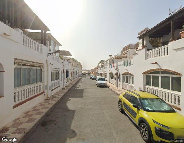
Street View

Property View

Street View

Situation Map

Record outline Surface: 1.894,45 m² Longitude: 182,51 m Average width: 10,38 m Width: 8,04 – 12,71 m

Location Map

Record outline Surface: 1.894,45 m² Longitude: 182,51 m Average width: 10,38 m Width: 8,04 – 12,71 m

Physical Data

Length of the road
182,51 m
Maximum Width
12,71 m
Average Width
10,38 m
Minimum Width
8,04 m
Extreme Limit 1
Parcela catastral 04029A091000720000IH
Extreme Limit 2
Avenida Mar de Alborán
Condition Status
Good
UTM Coordinates
37M 250048 9677539
Geographic Coordinates
36.7514323, -2.9151193
Physical Description
Calle con acera de losa hidráulica en ambos lados y calzada de asfalto continuo en buen estado de conservación, de doble sentido de circulación y con zonas de aparcamiento.

Image Gallery (0)

No images available

User manual
Loading the manual…