Cargando…
Coat of arms
Town Hall of Balanegra
Ayuntamiento de Balanegra
Public inventory view
Version v—
Access
Company Logo info@inventariomunicipal.es

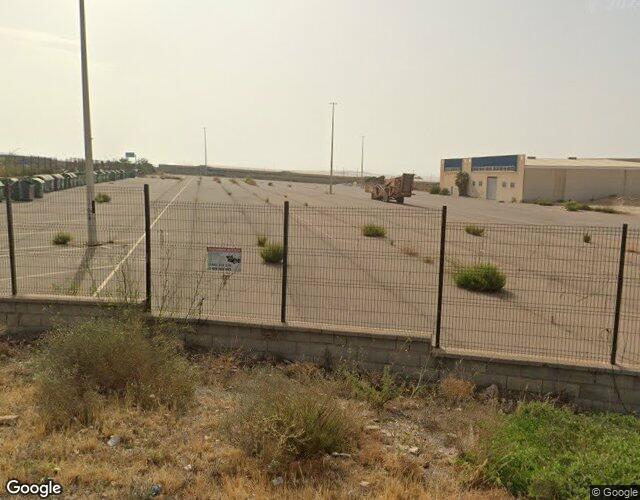
Aparcamiento en la Ciudad del Transporte

Record ID 525

Basic Data

Visible
Record Id
525
External references
Not recorded
Record Code
100101-525
Record Classification
Urban Land
Heading
100101 · Properties › Land › Urban Land
Denomination
Aparcamiento en la Ciudad del Transporte
Address
Calle Bultaco, 28 y 29 Suelo, 04713, Balanegra (Almería)
Urban Core
Ciudad del Transporte
Legal Nature
Public Domain - Public Use
Physical Nature
Urban or Developable Lands
Asset Status
Ownership
Functional Destination
Circulation of vehicles and/or people
Associated building
Not recorded
PGCP Account
210 Land and natural assets

Property View

Street View

Property View

Street View

Situation Map

Record outline Surface: 16.889,86 m² Perimeter: 744,05 m

Location Map

Record outline Surface: 16.889,86 m² Perimeter: 744,05 m

Physical Data

Land area
16.889,86 m²
Condition Status
Good
UTM Coordinates
30N 507720.23 4067765.05
Geographic Coordinates
36.7556065, -2.9135086
Boundary N
Autovía del Mediterráneo N-340
Boundary S
Parcela catastral 7879706WF0677N0001OH
Boundary E
Parcela catastral 04029A089000450000IU
Boundary W
Parcela catastral 7879712WF0677N0001DH
Physical Description
Not recorded

Cadastral Data

Cadastral Reference
7879710WF0677N0001KH
Cadastral Valuation
Not recorded
Cadastral Land
Not recorded
Cadastral Construction
Not recorded
Cadastral Reference
7879711WF0677N0001RH
Cadastral Valuation
Not recorded
Cadastral Land
Not recorded
Cadastral Construction
Not recorded

Image Gallery (0)

No images available

User manual
Loading the manual…